Auk 3 Snap (AWC3S) Tetracam's Smart Agricultural Wireless Global Snap Shutter Camera Hardware Configuration Software Features System Specifications GPS/IMU Option Browser Interface Overview |
  |
|
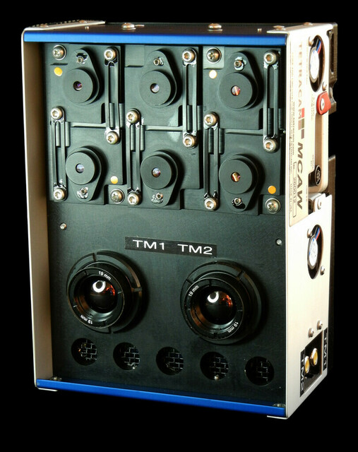
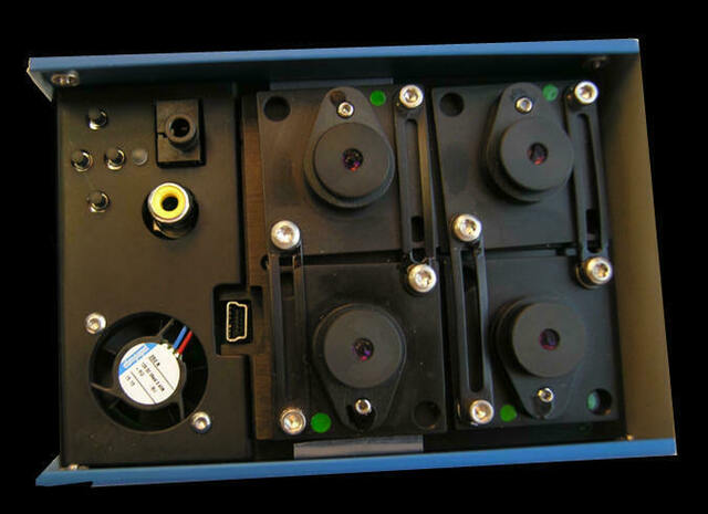
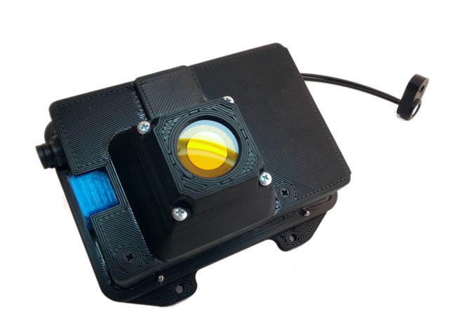
The Auk 3S is an entry level low priced global shutter camera for agricultural applications. The system features an integrated ILS measurement system for down-welling radiation that can be used to generate accurate reflectance data for the NIR, Red and Green bands. The unit can be equipped optionally with an internal IMU and GPS, making it unnecessary to supply anything to the unit except power on most missions. The unit is based on the “smart camera” Linux controller technology first introduced in our MCAW cameras. It features a user friendly browser interface, and a variety of Linux interfacing options available from the wireless interface. Files can be downloaded with a browser button, or via a Samba network connection using a File Explorer. There is also a USB2 and Ethernet connection for situations in which a wireless transceiver is not available. Smart NDVI processing is available in the camera and the options to customize it are numerous. The camera has an interface connector with power, ground, picture switch and RS232 serial I/O. It can run on any input voltage from 6 to 30 volts DC. Image storage memory is 16 GB by default, but the unit can optionally be configured with 48 GB of capture memory. The image sensor is a 1280 X 960 global shutter CMOS device. The global or “snap” shutter minimizes motion blur, and makes the camera well suited to low level flight operations, where there is significant translation speed of the subject. |
|
The camera is capable of smart NDVI processing; in other words, it can perform extraction of NDVI images and false color RGB images as background tasks while images are being acquired, eliminating the need for post processing prior to generating a mosaic. Image capture can be automatic, based on GPS offset or time delay. Capture can also be triggered from the serial port or Take Picture logic signal. A GPS listener on the serial port allows external GPS or Mavlink 1.0 autopilot data to be appended to the images as metadata. The unit interfaces to the Tetracam PixelWrench and Log Distiller utilities for batch processing of the captured data. Internal GPS and IMU data are also present as metadata in the images. The Auk has a GPS/IMU option available; accordingly, an Auk user can geolocate their imagery as well as provide ILS metadata and logs. The GPS/IMU data is supplied at the same time as ILS data to the Auk. When a user is done with an image taking mission, their data will be ready to process in PixelWrench or other software, GPS/IMU and ILS information available either via image metadata or logs. The IMU part of the option consists of heading, pitch, and roll. |
|
|
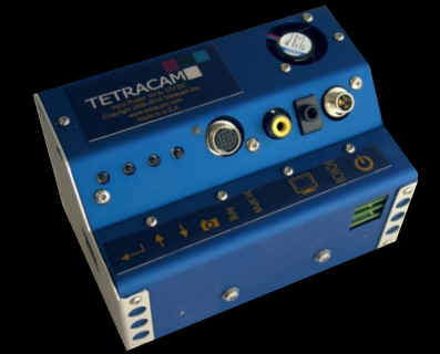
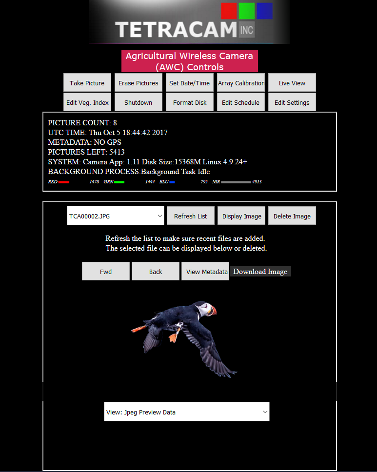
The Auk can be entirely controlled via a web browser, which means a tablet, desktop, laptop, or smartphone can administrate the Auk easily, as can be seen from the image to the left. Taking pictures, erasing pictures, setting the date and time, viewing images, and editing settings, for example, can all be done by clicking the buttons on the main page of the interface. Pictures taken can be reviewed and a live video feed is available. Individual pictures may also be downloaded. When reviewing pictures, raw image data can be selected to be shown as well as various indices, such as false color NIR/Red/Green RGB and NDVI extractions. This is done without the need of transferring the pictures to another device. If the user is close enough to their Auk while it is taking pictures, such as in a manned aircraft, they are able to review the pictures while the mission is taking place to be sure everything is going according to their unique plan. |
| Power | 220mA at 12 volts, 6 to 30 volt input |
| Weight | 180 grams |
| Environmental | Commercial Temperature / Humidity Ranges |
| Temperature | 0 degrees Celsius to 40 degrees Celsius (32 degrees Fahrenheit to 104 degrees Fahrenheit) |
| Humidity | Less than 85% relative humidity, noncondensing |
| Data Storage | Micro SD memory card, up to 48G |
| Included Software | PixelWrench2 image processor |
| Host Interface | Ieee80211 wireless, Gigabit Ethernet networking, and USB2 data transfer |
| Command / Control | RS232 I/O for reports measurements Auto trigger mode (continuous capture, GPS offset) Web browser display and user interface |
| Performance | Two images per second capture rate Four built in band measurement filters |
| Options | Internal ILS Internal IMU Extended ILS sensor cable |
![]()
Smart NDVI cameras are multispectral cameras for precision agriculture that can calculate vegetation indices and create false
color NDVI images without the use of an image processing program accessory.
Precision Farming and Forestry need multispectral camera and NDVI camera images to create orthomosaic maps
that allow interventions to be optimized. NDVI phenocameras that can perform time lapse photography are best for slow growing flora, while faster
growing commercial harvests are best served by airborne NDVI mapping cameras.