 |
||
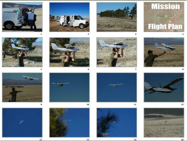
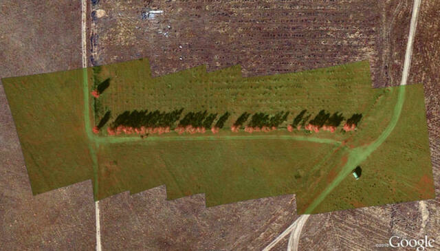
The photos below were taken during a flight test of the Triton on January 13, 2012. The test was executed by Antonio Liska of Robota, Danny Hajicke and David Dvorak of Field of View LLC, and Bill Rood and George Ismael of Tetracam. The Triton's mission was to image a row of conifers in the desert. The craft was hand-launched by Danny Hajicek of FOV. During the flight, the Triton continually reported its position to the ground control station located in the Tetracam van below. The mission plan called for the craft to take off, climb to 400 feet (AGL), circle to the end of the trees, image the entire row and then land along the same leg of the route that the craft had followed during take-off. The craft completed its mission flawlessly, gently belly landing on the desert floor exactly at its pre-planned location. The color/near-infrared images captured during the mission were stitched together by David Dvorak of FOV using Autopano Pro and geo-referenced using Google Earth. They are shown at the bottom of this page.
Mission Photos
Resultant Image Mosaic
Link to Triton Video on You Tube
|
||
|
||