|
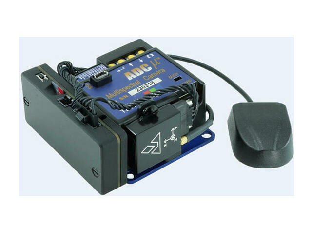
The Field of View GeoSnap VN-TC
heightens georeferencing
accuracy and streamlines the production
of orthomosaics for Tetracam's ADC Micro, ADC Lite or Mini-MCA
multi-spectral imaging systems. This is accomplished by
seamlessly fusing VectorNav's best-in-class VN-200 GPS-aided
Inertial Navigation System (GPS/INS) with these systems to
generate highly accurate position/attitude metadata that is
correlated with each captured multi-spectral image.
Accurate georeferencing is essential for site-specific treatment of
vegetation problems. The GeoSnap excels in this area. The VN-200 GPS-aided Inertial
Navigation System (GPS/INS) is capable of sub-degree attitude
accuracy with pitch/roll accuracy of 0.25 degrees and heading accuracy of 0.75
degrees. (Accuracy values from VectorNavís VN-200 datasheet). |
|
|
 |
|
In addition
to its accuracy, the GeoSnap VN-TC also possesses a number of
parameter-based triggering features, such as distance based triggering, that
enables the precise amount of along-flight-line overlap to be achieved
independent of the wind conditions. The GeoSnap VN-TC can also be configured
to only trigger image capture above a certain altitude, and when the magnitude
of the pitch/roll angle does not exceed a set limit. The GeoSnap VN-TC
augments Tetracam cameras to create a truly effective multispectral imaging
system that can be mounted and used on any suitable aerial platform.
The unit fits on to the ADC Micro
(pictured at left), the ADC Lite (pictured below left), and
Mini-MCA systems (pictured below right). |
|