
| AeroScientific FlightPlanner The Ultimate Flight Planning Software |
 |
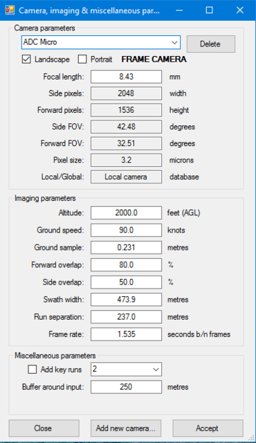
Flight planning is the first step to ensuring that aerial imagery is captured at the right time and place. A good flight plan results in a dataset with adequate overlap and detail to guarantee downstream processing like point cloud generation and mosaicking will succeed.
Tetracam recommends AeroScientific FlightPlanner. A simple to use, straightforward user interface and informative user guide will have you planning your next flight in no time.
|
Classic edition:
Pro edition:
Ultimate edition:
|

|
  |
  |
 |

Smart NDVI cameras are multispectral cameras for precision agriculture that can calculate vegetation indices and create false
color NDVI images without the use of an image processing program accessory.
Precision Farming and Forestry need multispectral camera and NDVI camera images to create orthomosaic maps
that allow interventions to be optimized. NDVI phenocameras that can perform time lapse photography are best for slow growing flora, while faster
growing commercial harvests are best served by airborne NDVI mapping cameras.